Why Rivers So Often Draw the Lines of a Settlement
Why rivers draw settlement lines: learn how water shapes building sites, crossings, and gathering places, and why its influence changes from one town to another.
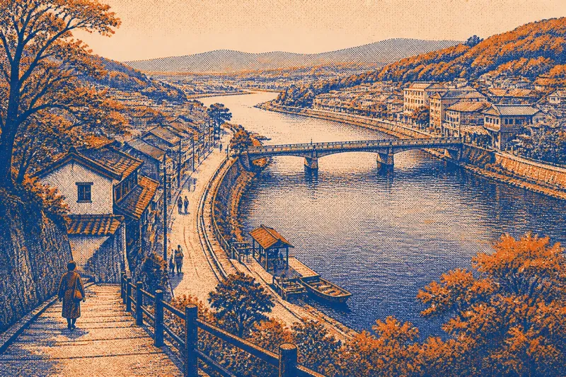
At a bend in an Eastern river, a street may end at a low landing while another follows the bank toward a bridge. That arrangement is no accident: rivers draw settlement lines by offering routes and meeting places while also dividing land that people need to cross. Their influence depends on the river’s shape, its changing water, and the ways residents use each bank.
Why do settlements form beside rivers?
People build near rivers because water brings several everyday needs into one place. It can supply households, support gardens and workshops, carry goods, and connect a settlement to other communities. A riverbank can also offer a clear edge for roads and property, making it easier to orient a growing town.
Yet proximity does not mean every building stands at the water’s edge. A settlement may occupy a terrace above the floodplain, with paths descending to a landing or a mill site. The higher ground offers a drier place to live, while the lower bank remains useful for work, access, or seasonal activity.
In Eastern towns, the river’s role may sit alongside older roads, rail lines, ports, or industrial corridors. A river can make a location valuable without being the only reason people choose it. To understand the layout, look for how the water connects to the street network, rather than treating the shoreline as a complete explanation.
How does a river shape building locations?
The bank’s height and stability matter as much as its closeness to water. A broad, level floodplain may provide convenient access but also be exposed to inundation. A bluff or terrace can offer a more secure building site, though steep slopes may limit direct access and make routes down to the river less convenient.
Soils and drainage influence where buildings cluster. Low, wet ground may remain open or be used for paths and recreation, while firmer ground supports streets and blocks. On a map, a curved edge in the street grid may follow a bluff, a former channel, or a parcel boundary shaped by the river. The visible pattern can reflect many generations of decisions.
Older landings and working waterfronts often leave a mark even after their original use fades. Streets may still point toward a former ferry approach; a broad road may end where cargo once met the river. In other places, redevelopment turns the bank toward walking paths and public space. The water remains a reference point, but the buildings facing it may serve very different purposes.
Why do bridges shape town centers?
A bridge concentrates movement. Roads from either bank meet at a limited number of crossing points, so shops, inns, services, and public buildings may cluster near the approaches. The bridge can turn a natural barrier into a shared route, making nearby blocks feel like a center even when the settlement has other commercial streets.
That effect is strongest where the crossing is practical and dependable. A narrow channel with firm banks may invite a bridge at a convenient point. A wide river, shifting channel, steep approaches, or vulnerable low ground can make crossings harder to place. Where bridges are far apart, each one may connect a different neighborhood or road network rather than draw the whole settlement together.
Imagine a small town whose main street reaches a bridge beside a former ferry landing. If residents improve the path from the bridge to the shops, the observable result might be a clearer pedestrian route and more foot traffic along that block. The river has not changed, but a decision about the crossing approach can alter which streets feel central.
When does a river divide a settlement?
A river divides a settlement when the cost or inconvenience of crossing outweighs the ease of moving along its banks. A bridge may be distant, a ferry may serve limited hours, or the banks may rise too steeply for easy access. In such places, opposite shores can develop separate street patterns, services, and local identities.
Even with a bridge, the two sides may not function as one neighborhood. The routes leading to the crossing can be indirect, or the bridge may carry through-traffic without connecting to nearby streets. Residents may use the river as a landmark while treating the opposite bank as a separate destination.
Look for more than the number of bridges. Notice where roads meet them, whether sidewalks continue across, and whether public paths reach the water on both sides. A river may be crossed often by vehicles yet remain difficult to approach on foot. Conversely, a modest crossing can link daily destinations when it joins streets that people already use.
What changes a river’s influence?
Water levels and channel behavior shape the practical relationship between town and river. Seasonal high water can make some low areas unsuitable for permanent buildings, while erosion or shifting banks may alter paths and parcels. The river’s width, current, depth, and navigability also affect whether it serves mainly as a route, a boundary, a source of work, or a place for recreation.
Human alterations can change that role. Dams, levees, channels, embankments, and industrial infrastructure may control access or redirect movement. A levee can protect built areas while separating residents from the water. A channelized stretch may be easier to manage but less connected to the patterns of a natural bank. These changes often leave visible seams in the town’s layout.
Local rules, flood maps, and site conditions matter when deciding where to build or how to use a riverfront. For a property or construction decision, consult the relevant local authorities and qualified professionals rather than inferring safety from appearance alone.
How can you read a river town?
Start with the relationship between the river and the street grid. A map can show whether roads run parallel to the bank, end at it, or bend toward crossings. Then compare the map with what is visible on foot: changes in elevation, retaining walls, stairs, docks, parks, and gaps in the built edge can explain why access is concentrated in certain places.
Pay attention to the uses along each reach. A public path, a working facility, a wooded bank, and a residential frontage create different kinds of contact with water. The river may be prominent in a town’s image but absent from ordinary routines if fences, steep slopes, or roads keep people away from it.
Also notice where people gather. A bridge approach, a landing, a riverside park, or a broad stretch of walkable bank can become a meeting place because it joins routes and offers room to pause. These places may be modest; their importance lies in how they connect everyday movement rather than in their size or appearance.
Does every river town face the water?
No. Some settlements turn toward the river, while others orient their main streets toward a road, rail line, harbor, or higher ground. Where the bank is steep, flood-prone, industrial, or difficult to reach, the river may shape the town’s edge without serving as its public front.
What appears to be a town facing away may still depend on the river’s crossings or historic routes. Conversely, a handsome waterfront can be a later public setting rather than the original center of daily life. The clearest reading comes from comparing access, building patterns, and current use instead of assuming that the shoreline tells the whole story.
Rivers draw settlement lines because they gather movement on some routes and interrupt it on others. To see how that balance works in a particular place, trace a street to the bank, find the nearest crossing, and note where the ground rises. Those ordinary details reveal whether the river acts as a corridor, a boundary, a gathering place, or several of these at once.